3.4.1. Rules for drawing buildings
Techniques for drawing and editing buildings are similar to those for drawing and editing all simple polygonal items on YME.
See:
Note
You can use individual 3-D models for some buildings that have a complex configuration. The requirements for such models are described at https://yandex.ru/project/maps/3d.
The employees may simplify or modify the shape and geometry of some buildings, as well their positioning relative to satellite imagery, to ensure that 3D models and their entrances are displayed correctly.
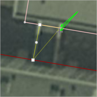
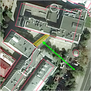
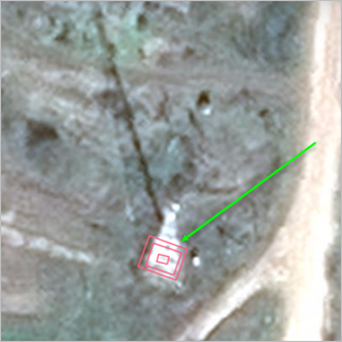
In addition, when drawing buildings consisting of adjacent or overlapping structures (of different heights or with different addresses), individual polygons should be drawn in snapping mode. In this mode, the vertices of the new polygon snap to the previously drawn building polygon. Just click  (Snapping mode).
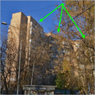
The green arrows in the drawing point to the positions of the cursor and the vertex of the polygon that snapped
to its neighbor polygon (which in turn gets highlighted when they snap together):
3.4.1.1 Drawing and editing rules for buildings
Follow these rules when you draw buildings:
3.4.1.2.1
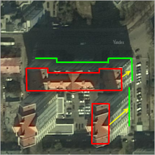
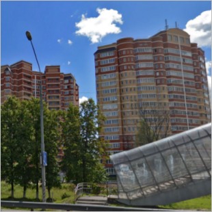
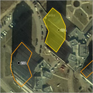
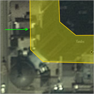
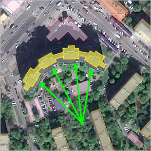
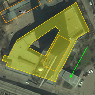
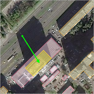
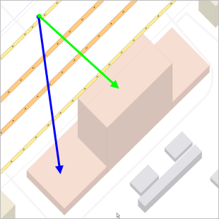
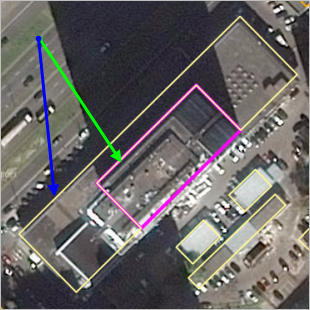
When drawing a building, keep in mind that satellite images are typically taken at an angle to the ground. That is why roof polygons are not properly aligned with footprints (footprints are polygons of a building's foundation, and they are the things that actually get put on the map). The higher the building, the more pronounced this misalignment is (see picture: roof polygons are highlighted in red, footprints are highlighted in green, and the yellow arrows show the misalignment):
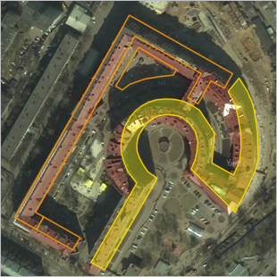
All structures, including buildings of the curved and round shape, must be drawn strictly on the Foundation (footprints), except for single-story apartment buildings and buildings in the private sector, drawn using the copying tool (see 3.4.1.2.1):
If the shape of the building's roof doesn't match the foundation, draw the building based on the shape of the roof except where the roof gradually narrows relative to the foundation.
Note
When drawing buildings, only include awnings and canopies in the building's polygon if the conditions described in paragraph 3.4.1.1.4 are met.
If photos are not enough to determine the exact shape of a footprint or a building under construction, you can follow schematics instead:
|
|
|
Note
When drawing rectangular footprints, if the building you drew doesn't appear rectangular, use the Corner alignment mode or Make angle 90 degrees tools (see 2.7.3.1. Drawing simple polygonal items).
It's more reasonable to draw a polygon following the roof, and then drag the polygon to match the footprint. For information on how to drag a polygon, see Section 2.7.3.2. Simple polygonal items: editing techniques.
When editing the shape of an existing building, align items that belong to that building (entrances, address points, organizations) with the updated geometry.
-
3.4.1.1.1.1
-
If you're drawing private area housing or a one-story block of flats, you can copy-and-paste a polygon from a similar building instead of drawing it from scratch.
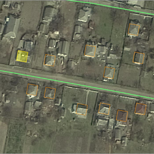
However, the building in the private area you're copying shouldn't differ from the target building in length and height by more than a factor of two. The geometric center and the shape of the buildings should match.
Building rendered exactly on a picture, you should not replace the copied building with inaccurate geometry. This is considered an error.
-
3.4.1.1.2
You do not need to draw any protrusions and impressions in polygons of multi-story buildings if those curves are less than 5 meters long. However, simplifying already existing ones is considered an error.
For example, the photo on the left shows a ledge (see arrow on right):
|
|
|

If you should draw protrusions or impressions in polygons at all, either draw all of them or don't at all. You cannot pick and choose whichever ones you want to draw.
|
|
|
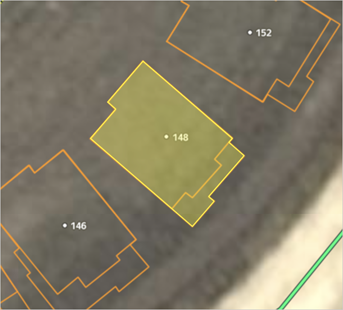
You can draw buildings that have the same number of stories and are located wall to wall with a gap of less than three meters between them as a single polygon (for example, co-op garages).
3.4.1.1.3
If a building has internal polygons (such as courtyards), you should draw them in:
|
|
|
3.4.1.1.4
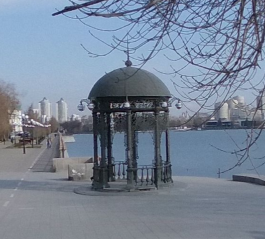
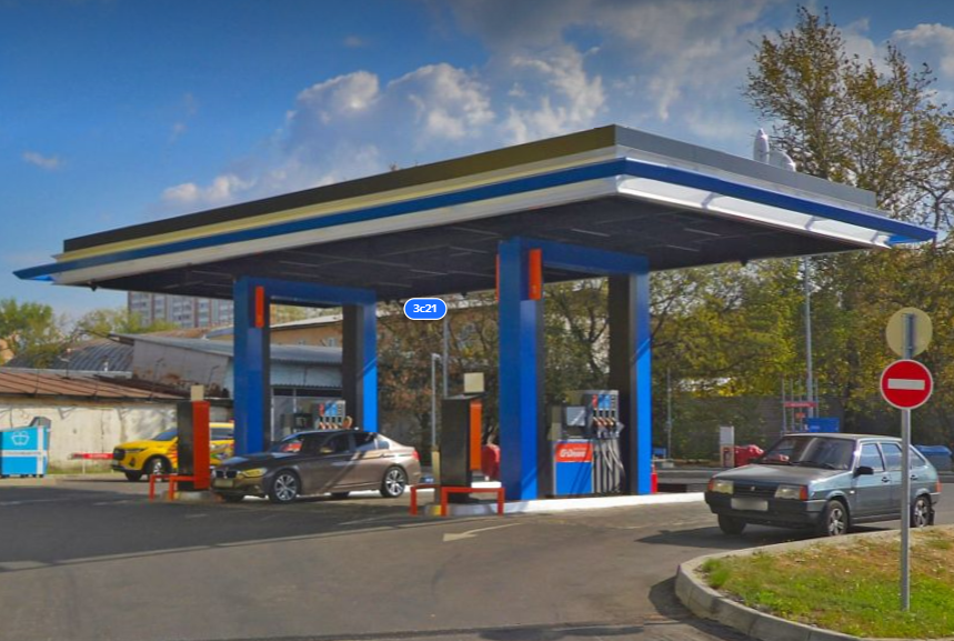
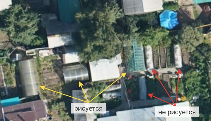
You can draw awnings and canopies (non-insulated structures that function as overhead coverings supported by posts attached to one or more walls) and framed greenhouses on the map if these structures are not part of a building. Examples of structures that can be drawn: rotundas, public transport stops, canopies at childcare centers, canopies at automatic filling stations.
The image shows examples of greenhouses that you can and can't draw in Yandex Map Editor.
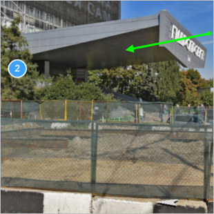
On the pictures below: the photo on the left shows an awning, the red arrow in the diagram on the right shows where the awning is located:
|
|
|
Note
The exception to this rule is if you need to draw the awning in order for the three-dimensional model to display correctly.
3.4.1.1.5
Buildings that are made up of several structures or have multiple addresses can be divided into separate polygons.
-
3.4.1.1.5.1
-
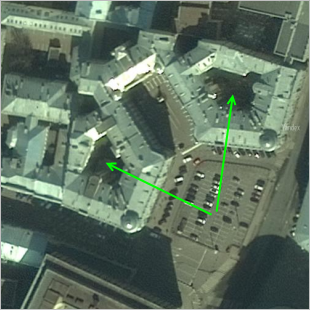
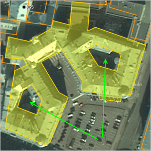
If parts of a single building differ in height (floor count), it's preferable to draw each part as a separate building with its own polygon.
When drawing parts of a building with varying floor counts, you may use overlapping polygons:
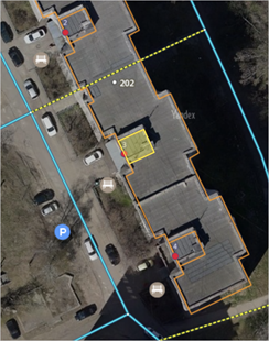
Use overlapping polygons to draw structures that are located on rooftops:
Note
If a building is on top of a podium, enter the total of the podium and building height as the building height.
For the building in the photo below, the height of the podium is 9 m and the part of the building on top of it is 16 stories high (with a height of 16×3=48 m in accordance with the 3.4.2.3. Rules, which states that each floor should be counted as three meters).
Meaning that the building's total height consists of the podium's height and the height of the main section on the podium: [16 x 3 + 9] = 57 meters.
For instance, the building in the photo has two areas with differing height (the higher one highlighted by the green arrow, and the lower one highlighted by the blue arrow):
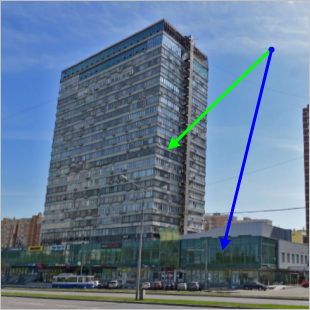
These two areas must be drawn as separate structures for the building to display correctly:

This will ensure that the building displays properly on the map:
In some cases, such areas may even be attributed different item types. For example, a high residential building (green arrow) may be combined with a low-story annex occupied by a shop (blue arrow):
In this case, you should draw the sections that differ by number of stories as two different buildings on Yandex Map Editor:
-
-
3.4.1.1.5.2
-
Draw passageways between the buildings as separate polygons:
-
-
3.4.1.1.5.3
-
We recommend drawing truss structures that taper towards the top (such as cellular towers) using three or more building polygons of various heights (see the drawing on the left). That way they will actually better resemble the real thing on the map (right picture):
-
3.4.1.1.6
When drawing internal polygons, follow 2.7.2. Rules for using internal polygons.
3.4.1.1.7
When drawing buildings, follow these rules: 2.7.1. General rules for drawing polygonal items.
3.4.1.1.8
Don't draw underground buildings. However, you can draw parts that are visible aboveground.
Culture and leisure
type items can also be used for mapping grounded vehicles (decommissioned ships or aircraft) without a pedestal that are monuments or museum exhibits.
You can draw temporary (such as food trucks
) or seasonal structures as Building
type items if they operate on the same place for at least two months and drawing them doesn't violate other rules of Yandex Map Editor.
3.4.1.1.9
If there's an address point located in the building, it shouldn't end up outside the shape of that building during editing. If, during editing, the address point ends up outside the building's shape, correct this shape.
3.4.1.2. 3D models of buildings
You can use individual 3-D models for some buildings that have a complex configuration. To add a 3D model without texture to Yandex Maps, create it and send it to us via the form at https://yandex.ru/project/maps/3d.
Alert
A special offer regulates the legal aspects governing the use of 3-D models.
Since 3D model parameters differ from map item parameters added directly on Yandex Map Editor, the use of these models is not stipulated in the Yandex Map Editor User Agreement .