3.10.2. Rules for adding attributes to hydrographic items
When you create a hydrography item, the category selection menu opens:
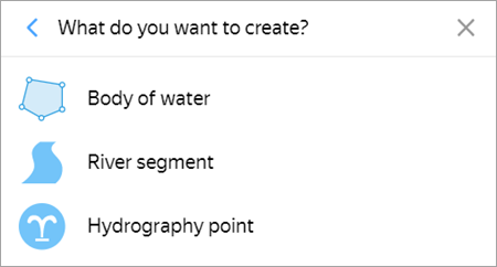
Select the appropriate category from the menu to open the attribute panel for the map item. Hydrographic items are represented using placemarks (for Hydrography points
), lines (for Areas of riverbed
), and polygons (for Bodies of water
).
Rules for adding attributes to these type of items are found below.
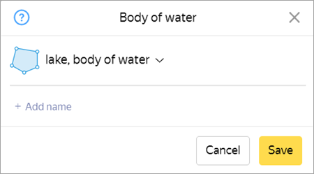
3.10.2.1. Reservoir (polygonal hydrography item)
-
The attribute panel for bodies of water (polygonal hydrographic items) items looks like this:
3.10.2.1.1. Type
-
Select an item type from the list.
If the item name specifies its type and proper name (for example, Atlantic Ocean, White Sea, Bering Strait, Lake Ladoga, and Sulutor Lakes), select the corresponding item type from the list:
- lake or other body of water
- ocean
- sea
- bay or harbor;
- strait
- reservoir
- pond
- glacier
- group of lakes
If the item name specifies a type that doesn't actually correspond to this item, the item is assigned the
lake, body of water
type. For example, the Groznenskoye Sea isn't actually a sea, so it is assigned thelake, body of water
type, while the official name retains the locally used type — the Groznenskoye Sea.Unnamed hydrographic polygons, as well as items with no dedicated type (unnamed ponds and lakes, polygonal rivers, streams, channels, fountains, sewage treatment plant reservoirs, quarry lakes, and so on), should be assigned the
lake, body of water
type.The
Swamp
andOutdoor pool
types can be assigned to items of those types even if they don't have a name.Also assign the
swamp
type to terrains that are not drawn in theAdministrative division
layer.
3.10.2.1.2. Name
- Hydrographic items are named in accordance with the general rules. See 3.1.3. Map item naming rules.
3.10.2.1.3. Duplicate a riverbed or channel with a polygon
-
When you duplicate a riverbed or channel using a polygon, assign Reservoir attributes to that item (see point 3.10.2.1.1).
Don't name these polygonal items: the
Name
field should be left blank.
-
3.10.2.2. Section of riverbed (linear hydrographic item)
-
The attribute panel for a section of riverbed looks like this:
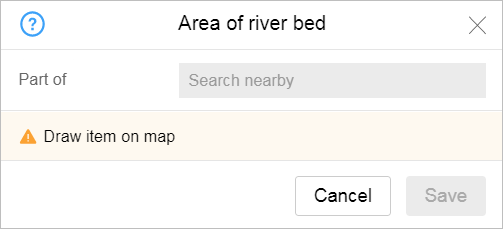
-
3.10.2.2.1. Part of
-
The
part of
attribute indicates that a section of riverbed belongs to a certain river. Specify the name of the river the section belongs to.As you start entering the name of the river into the field, a list of suggestions comprised of rivers that are already on the map will appear automatically:
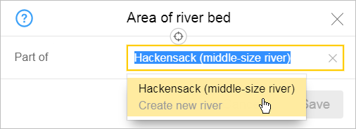
When you fill in the field:
- If the river is already on the map, then select its name from the list.
- If the river is not on the map, you must fill in this field manually: enter a name for the new river and it will be created.
- After you save the item, the name of the river displays in the panel as a link that opens the river editing panel. Editing techniques for such composite linear items are described in Section 2.6.2. Composite linear objects.
For more information about river names, see 3.10.3.2. Name of river.
-
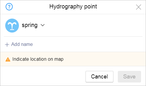
3.10.2.3. Hydrography point (point hydrography
)
-
The attribute panel for a hydrography point looks like this:
-
3.10.2.3.1 Type
-
When you enter an item type, select the value from the list:
- spring (source)
- Fountain.
- waterfall
- well
- geyser
- Water pump
3.10.2.3.2 Name
- Hydrographic items are named in accordance with the general rules. See 3.1.3. Map item naming rules.
-