2.2.5. Change the map type
Yandex Map Editor works like other electronic maps: it is made up of many layers, each of which stores information about particular types of map items. You can change the way map layers are displayed:
2.2.5.1. Choice of backdrop
To choose a backdrop, click
 ─ Switch the backdrop to map or
 ─ Switch the backdrop to satellite.
The current backdrop (Map or Satellite) will switch to the other one.
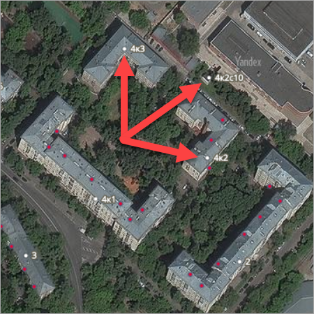
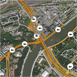
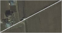
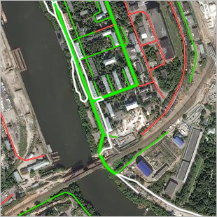
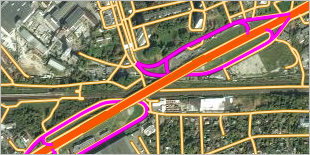
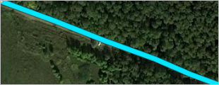
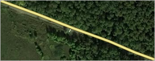
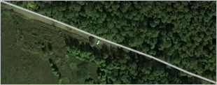
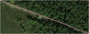
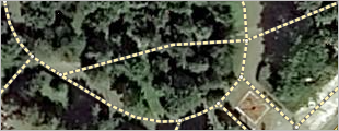
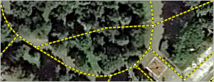
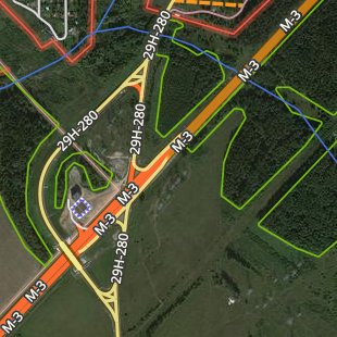
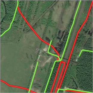
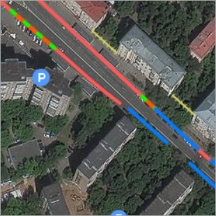
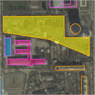
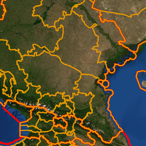
The Satellite backdrop displays images of the territory taken from space:
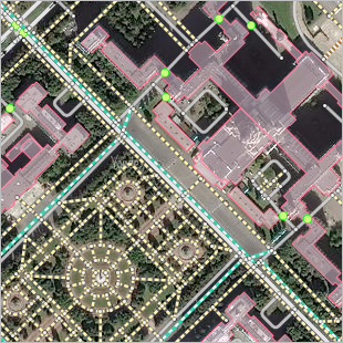
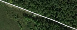
The Map backdrop displays Yandex Map Editor in real time (with all edits, including those that have not passed moderation yet).
Note
When you switch backdrops (Map ↔ Satellite), the layer settings (see below) are not saved (so they may differ from one another).
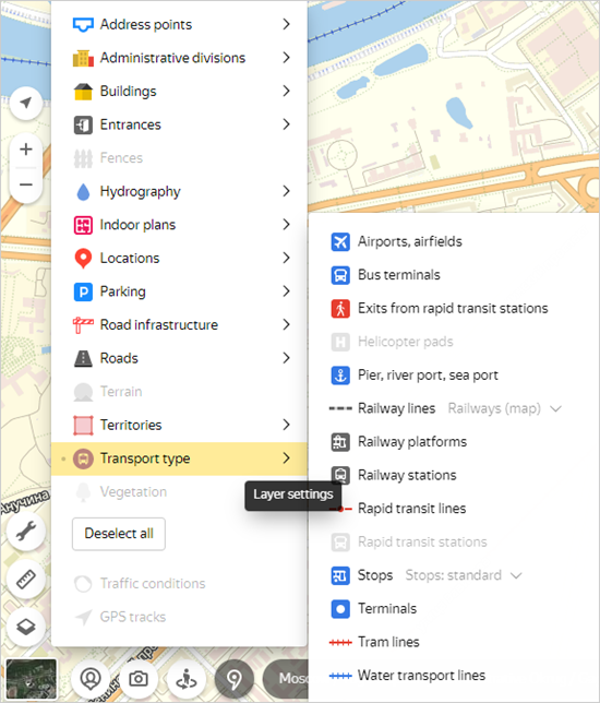
2.2.5.2. Choice of layer
To select and configure a map item layer:
-
Click Layers
 .
. -
In the menu that opens, mark the layers that you want to display on the map. To turn a layer on or off, left-click its name (the names of enabled layers are in color, and disabled ones are gray).
The Select all/Deselect all button turns all map layers on/off simultaneously (alternatively, use the shortcut Shift + Ctrl + H).
-
Select the layer components you want to display on the map. They can be turned on and off independently of each other. To enable or disable a layer component:
- Click
 (Layer settings) to the right of the main layer.
 - Left-click the component name.
The names of enabled components are in color, and disabled ones are gray:
Note
When you turn off the main layer, all its components are turned off.
- Click
-
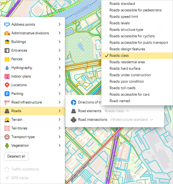
Select the display option for the layer component from the drop-down list next to its name:
Note
If there isn't a drop-down list next to a layer component name, only one display option is available for that component.
-
Disable interactivity for layers (or layer components) whose items shouldn't be highlighted when you hover your cursor over them. To enable or disable interactivity:
- Hold your cursor over the name of the enabled layer component.
- Click the
 (Layer interactivity) button that appears to the right of the name and display option.
If interactivity is enabled, the layer (or layer component) items are available for editing. If interactivity is disabled, the items are displayed on the map but can't be edited.
2.2.5.3. Layer display options
2.2.5.3.1. Address points
-
Standard. Address points are displayed on the map:
-
Link to postal code. The map displays address points and postal codes (points are linked to post offices): Select a postal code point to view a list of addresses associated with the postal code:
-
Postal codes. The map displays postal codes (points are linked to post offices):
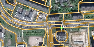
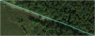
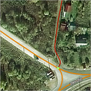
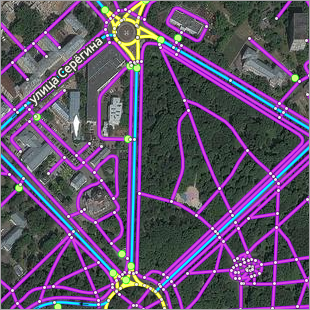
2.2.5.3.2. Roads. Road intersections
Specify the type of infrastructure displayed on the road map:
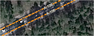
-
Infrastructure: standard. Traffic lights and speed cameras only display on large-scale maps (18 and higher); they won't display on small-scale maps (18 or less):
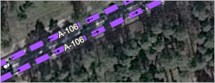
-
Cameras at small scale. Displays speed cameras not only on large-scale maps, but on small-scale ones (less than 18) as well:
-
Traffic lights at small scale. Displays traffic lights not only on large-scale maps, but on small-scale ones (less than 18) as well:
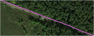
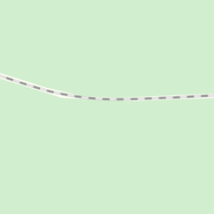
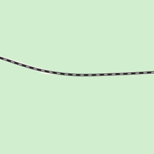
2.2.5.3.3. Roads. Road elements
Specify the road type displayed on the map:
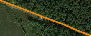
Standard
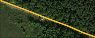
Roads above class 4 are color-coded (whereas roads of class 1-4 are represented using the same color).
Pedestrian access
Roads that are inaccessible to pedestrians are light blue, accessible ones are green, walking and bike paths (class 10) are yellow, pedestrian crosswalks (class 10, design features: pedestrian crosswalk) are orange:
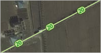
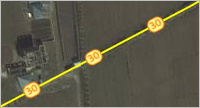
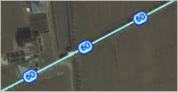
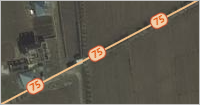
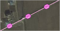
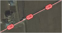
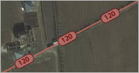
Speed limit
Color-codes roads according to speed limit:
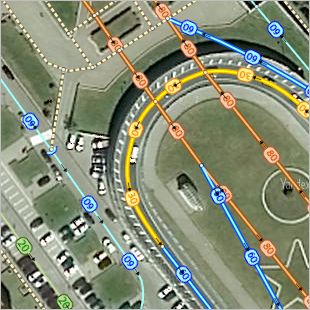
Speed limit ranges are color-coded (a specific speed limit is specified for each section of road):
|
Color-coding by speed limits |
Speed limits (km/h) |
|
|
not indicated |
|
|
5—20 |
|
|
25—55 |
|
|
60 |
|
|
65—85 |
|
|
90 |
|
|
95—105 |
|
|
110—130 |
|
|
more than 130 |
Note
Pedestrian and bike streets are designated using a separate color (there is no speed limit for them).
Levels
Displays sections of road that begin and end on different levels using different colors.
Sections that are of a uniform level are represented using solid lines. Dotted lines represent road sections that go up or down, the arrows of the line are directed from the lowest to the highest level of the road section:
Type of structure
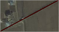
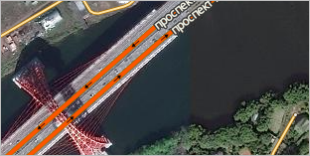
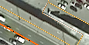
Displays sections of road made up of different types of structures (bridges, tunnels, stairs, ferry crossings, and ford crossings) using different colors.
|
Design features |
On the map |
|
Bridges — orange: |
|
|
Tunnels — green: |
|
|
Stairs — dotted line, standard color-coding: |
|
|
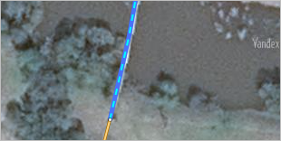
Ferry crossing — blue dotted line: |
|
|
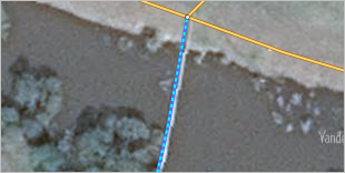
Ford crossing — blue dotted line (small): |
|
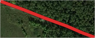
Accessibility to cyclists
- Red — road (classes 1-8) without bicycle access.
- Pink — road (class 6) accessible for cyclists.
- Black — road (class 7) accessible for cyclists.
- Black with red outline — road (class 7) with pedestrian access only.
- Blue (thin) — driveway or alleyway accessible for cyclists.
- Brown dotted line — dirt road (class 9) accessible for cyclists.
- Blue (thick) — walkway (class 10) accessible for cyclists.
- White with black outline — walkway without bicycle access.
- Yellow-and-green dotted line — bikeway (class 10).
- White-and-black dotted line — stairs and pedestrian crossings (accessible for pedestrians but not cyclists).
- Yellow — area with incorrect attributes (the bicycle access value is checked against other available attributes).
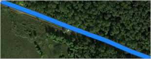
Accessibility to public transport
Roads of class 1 that include a public transport accessibility attribute are green (and if there is a section of road with a public transport lane going in the opposite direction, it is represented as a dotted line). Class 10 roads and class 7 pedestrian lanes (i.e. those that are inaccessible to public transport) are white. Class 1 roads inaccessible to public transport are red (it's worth checking these sections):
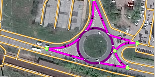
Design features
Roads are color-coded based on their design features:
|
Design features |
On the map |
|
None — yellow-orange: |
|
|
Two carriageways — orange: |
|
|
Circular road — purple: |
|
|
Exit — pink: |
|
|
Frontage road — red: |
|
|
U-turn — yellow: |
|
|
Pedestrian crosswalk — white: |
|
|
Access road — blue: |
|
class
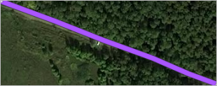
Color-codes roads of various classes so that users can visually determine how different parts of the road network are connected.
Note
Roads that are labeled with the Under Construction attribute (see 3.2.11. Under construction), are represented as dotted lines in the color that corresponds to their road class.
|
Functional class |
Standard road color-coding |
Color-coding by road type |
|
1 |
|
|
|
2 |
|
|
|
3 |
|
|
|
4 |
|
|
|
5 |
|
|
|
6 |
|
|
|
7 |
|
|
|
8 |
|
|
|
9 |
|
|
|
10 |
|
|
|
Under construction Roads |
|
|
Residential area
Roads are color-coded by class. Class 6 and 7 roads are marked with a red outline if they have the residential area attribute.
Pavement
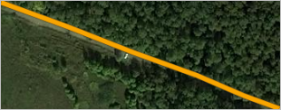
Sections of a road that are paved are orange and those without a surface are red.
Under construction
All roads under construction (except for class 10 roads) are class 7. Class 10 roads under construction (pedestrian) will still be class 10.
Orange represents road sections whose class was entered correctly; purple represents incorrectly categorized roads:
Poor condition
Roads in poor condition are purple:
Toll roads
Toll roads are bright orange:
Accessibility to cars
Roads with no car access are red:
Naming
Road sections that are part of streets and highways are displayed in blue, while the rest are purple.
Road sections are displayed in different colors based on the value of their construction type attribute (the naming scheme for such sections is outlined in the rules):
-
Exits, roundabouts, and U-turns that are not part of existing streets and highways are displayed in yellow.
-
Two-way road sections and frontage roads that are part of streets and highways are displayed in light brown, while those that aren't are displayed in pink.
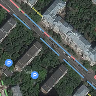
2.2.5.3.4. Parking
-
Parallel parking: standard / contrast:
Switching modes changes the colors on the map without changing the classes of parallel parking:
- Forbidden (red).
- Restricted (red and green dotted line).
- Paid (blue).
- Free (green).
Standard color-coding (left) and contrast color coding (right).
-
Standard color-coding:
Parking areas are marked with standard icons (blue):
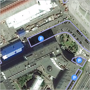
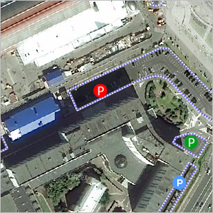
-
Color-coding by type — parking areas of different types are marked with differently colored icons (paid parking — red, residential parking — green, other — blue):
2.2.5.3.5. Buildings
-
Standard. Color-coded buildings by type:
-
Condition. Buildings are color-coded according to the condition they are in (standard, under construction, demolished, abandoned):
-
Height. Color-codes buildings according to their height:
-
With 3D models. On the map scale of 13 or higher, buildings with three-dimensional models are marked with red outlines:
2.2.5.3.6. Locations. Color-coding by attributes
Every business in Yandex Map Editor can be linked to an entry in Yandex Business .
-
Standard
Designates locations on the map using the following icons:
-
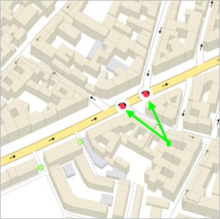
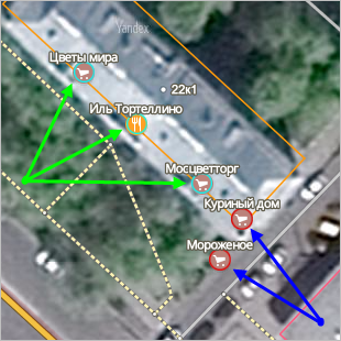
Linking organizations to Yandex Business
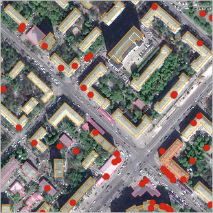
Organizations (locations) at map scale of 17 or more are represented using icons with borders. In the drawing on the left: the blue border represents organizations with a listing in Yandex Business (green arrows), and the red border represents organizations with no listings (blue arrows).
On map scales of 16 or lower, organizations that don't have listings in Yandex Business are represented by red circles (the drawing on the right):
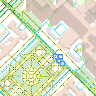
2.2.5.3.7. Transport. Stops
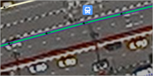
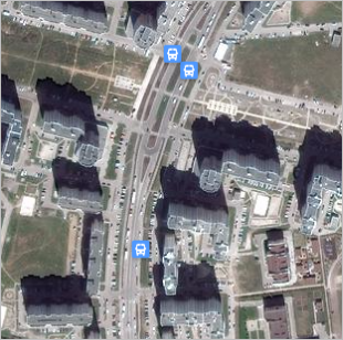
-
Stops: standard. Stops are displayed on large-scale maps (18 and higher), but they won't display on small scale maps (less than 18):
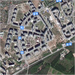
-
Stops: at small scales. Not only displays stops on large-scale maps, but on small-scale ones (less than 18) as well:
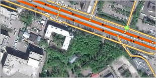
2.2.5.3.8. Transport. Railway lines
-
Railways. Railways are displayed on the large-scale maps, as well as on the small-scale ones (less than 18):
-
Railway: by category on the small-scale maps. Railways are displayed on the large-scale maps, as well as on the small-scale ones (less than 18):
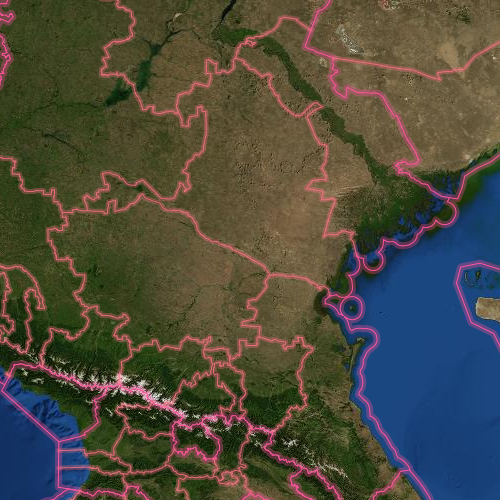
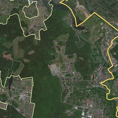
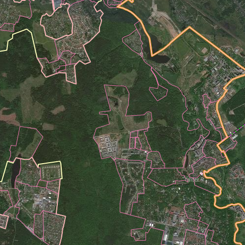
2.2.5.3.9. Administrative divisions. Administrative division borders
Only the items that are part of the selected high levels are clearly displayed on the map. The borders of lower-level items are shown with identical thin lines.
-
Standard. All administrative divisions are displayed on the map:
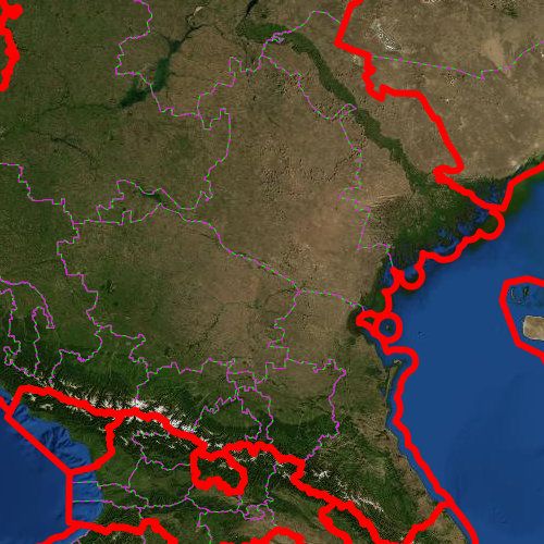
-
Country borders. Only country borders are clearly displayed on the map:
-
Borders of countries and regions. The map clearly shows country and regional borders:
-
Borders of countries, regions, and their districts. The map clearly shows country, regional, and district borders:
-
Borders of countries, regions, their districts, and localities. The map clearly shows country, regional, district, and locality borders:
-
Borders of countries, regions, their districts, localities, and city districts. The map clearly shows country, regional, district, locality, and city district borders:
2.2.5.3.10. Building entrances
-
Entrances. The map shows building entrances marked in one color:
-
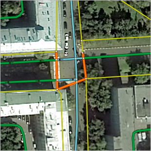
Entrances: apartment numbers. The map shows building entrances marked in different colors: green for entrances with at least one apartment range, red for entrances for which no apartment range is set.
2.2.5.4. Additional layers
2.2.5.4.1. Traffic conditions
This layer displays traffic, closures, and traffic events (it works the same way as in Yandex Maps ):
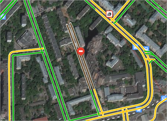
The traffic level is indicated by color:
 — Traffic is moving freely.
 — Traffic is moving slower in this area.
 — Traffic jams.
 — Complete standstill.
The following icons are used to display traffic events:
 — Accident.
 — Closure.
 — Other.
 — Road work.
 — Raised bridge.
 — Event that will happen in the future (for example, scheduled bridge raising).
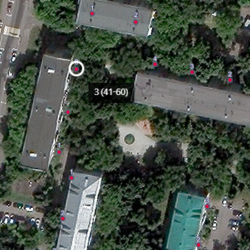
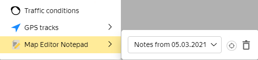
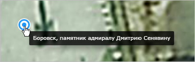
2.2.5.4.2. Entries from Map Editor Notepad
Layers from My Notepad are available for those who use Map Editor Notepad and have entries in it. To see a layer of notes taken in your Map Editor Notepad:
-
Click Layers
. -
To see the notes you took on a specific day, select a date in the My Notepad field:
-
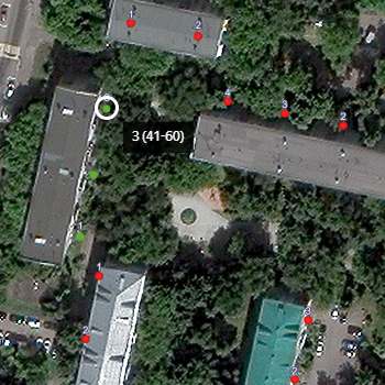
Click
 (Show all entries and paths traveled for that day).
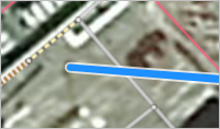
The map will display all entries for the date you selected:
and track your paths:
-
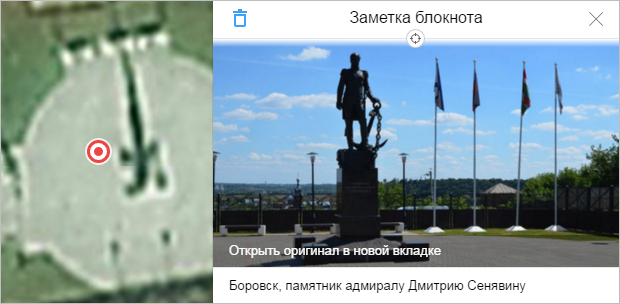
Click on the icon for the notepad entry. A panel opens where you can view your entry:
After you transfer the information from your entry onto the map, click
 on the panel (Delete) to delete your entry.
 -
After information from your entries and tracks has transferred onto the map, click
 (Delete) for the appropriate item in the My notepad list and all information for that date will be deleted: