Importing map items
You can import items from a file using one of the following formats:
To import:
-
Create a new map that's designed to import data from a file (data can only be imported to a new map).
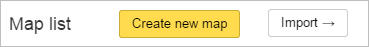
You can do this by clicking Import in your map list:
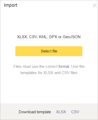
The Import window opens:
-
Click Select file and select the file that you want to import data from (you can perform a one-time data import from a single file).
Additionally:
-
After the import process has completed, data from the file you selected will display on the map you created and may be edited and saved.
KML
If you import data from a KML file, the map will include the following:
-
Placemarks (coordinates, description, label, color)
-
Lines (everything that can be set using the Constructor)
-
Polygons (all settings that can be changed using the Constructor)
If the file's metadata stores map names and descriptions, they will also be imported.
If the source file contains groups, they will not be saved.
The item color will be the closest to the original that is supported by Map Constructor.
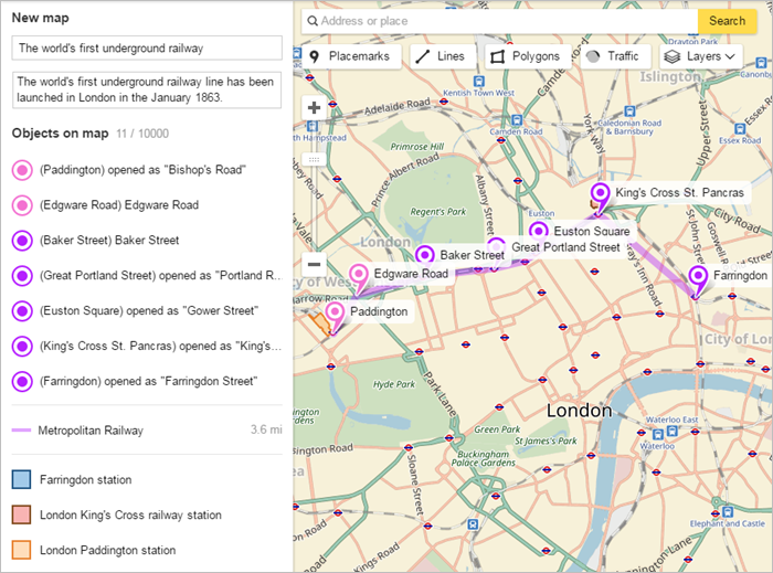
Example of results after importing data from a KML file (in English, but other language options are available):
Download the sample file at this link: Sample KML file.
You can also read about the KML format in the Exporting map items section.
GPX
When you import data from a GPX file, placemarks are added to the map (coordinates, description, label), along with routes and tracks.
If the file's metadata stores map names and descriptions, they will also be imported.
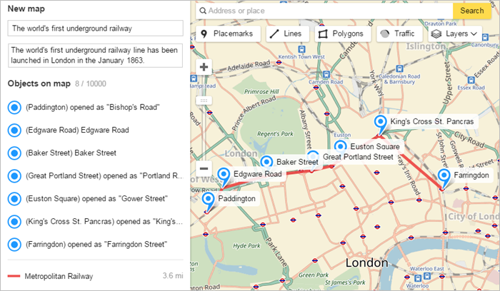
Example of results after importing data from a GPX file (in English, but other languages are also available):
Download the sample file at this link: Sample GPX file.
You can also read about the GPX format in the Exporting map items section.
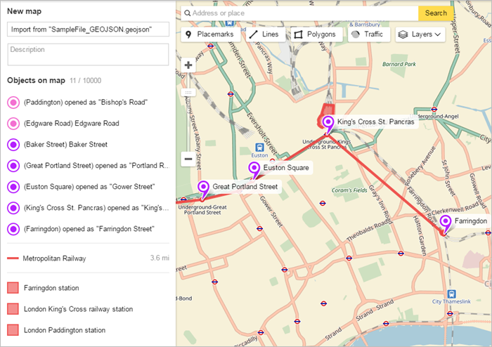
GeoJSON
When you import data from a GeoJSON file, placemarks (coordinates, description, label, number, color), lines (everything that can be set using the Constructor) and polygons (everything that can be changed using the Constructor) are added to the map.
If the source file contains groups, they will not be saved.
The item color will be the closest to the original that is supported by Map Constructor. Example of results after importing data from a GeoJSON file (in English, but other languages are also available):
Download the sample file at this link: Sample GeoJSON file.
You can also read about the GeoJSON format in the Exporting map items section.
CSV
When you import data from a CSV file, only placemarks (coordinates, description, label, number) are added to the map.
Files that data are imported from must follow this template:
-
Commas, semicolons, or tabs can be used as delimiters.
-
Order of fields:
1. Latitude.
2. Longitude.
The «Latitude» and «Longitude» fields must be filled in. All other fields can be left empty.
Coordinates are given in decimal format, where the integer and decimal parts are separated by a point.
Example: 51.52014078866054,-0.1044968729335983.
3. Description.
4. Label.
It's preferable to enclose the text value of the label and its description in quotation marks.
This is so that the system ignores characters that look like file delimiters. If text in the Description or Label fields contains quotation marks (for example, if your store is located in Russia where formal names are often set off in "quotes"), then enclose that text in quotation marks as well.
Example: If the label should be "World of Seeds" store, then write the value in the file as """World of seeds"" store".
5. Number.
Sample entry in a file prepared for import:
51.530216469900985,-0.12356737902929697,"at the opening of "King's Cross"","King's Cross Saint Pancras","162".
Download the template at this link: CSV template.
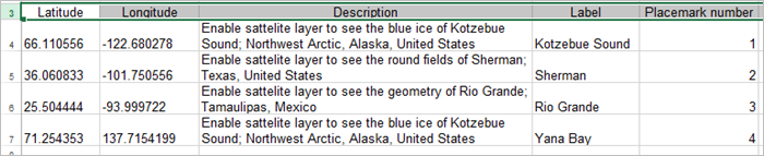
XLSX
When you import data from a XLSX file, only placemarks (coordinates, description, label, number) are added to the map.
Files that data are imported from must follow this template:
-
Order of columns:
1. Latitude.
2. Longitude.
The «Latitude» and «Longitude» fields must be filled in. All other fields can be left empty.
Coordinates are given in decimal format, where the integer and decimal parts are separated by a point.
Example: 51.52014078866054,-0.1044968729335983.
Alert
If a cell entry starts with the « - » (minus) symbol, then you should add a «'» (single quotation mark) to the beginning of it. Please note that the symbol will not display in the cell, but will display in the formula field:
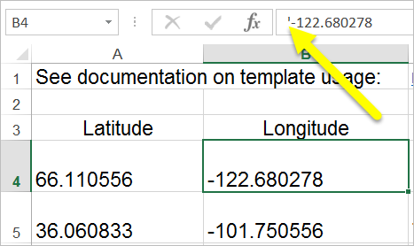
Otherwise MS Excel interprets the entry as a formula, which results in an error.
3. Description.
4. Label.
5. Number.
Download the template at this link: XLSX template.
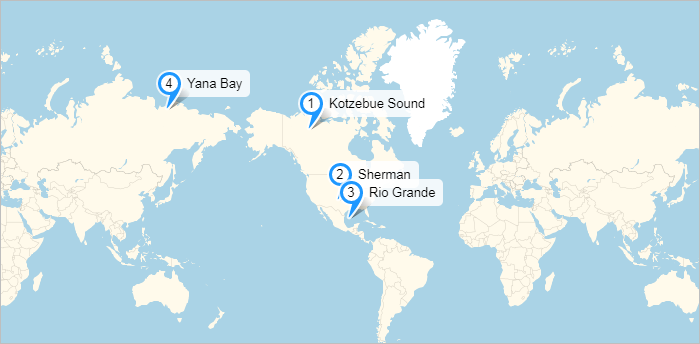
Example of data import from a file containing an entry in English (although other languages can be used as well):
Resulting map:
You can also go to:

Useful links
Alert
There are certain restrictions on item creation:
-
You can't add more than 10,000 items to a map (which includes placemarks, lines, and polygons).
-
A line or polygon can not comprise more than 1,000 vertexes.
If the number of vertexes that an item has exceeds the maximum, then the item may be simplified automatically (i.e. the excess vertexes are deleted, but in such a way as to maintain the overall appearance of the item).